


"Traffic Congestion" as Solvable, Part 4: Junction Repair: Decrease Dangerous Complexity by Increasing Safe Complexity
Redefining some functions, getting better outcomes

Complex, delicate things happen successfully all the time.
Complex systems also fail, all the time, for many reasonable reasons.
update: writing this the day after I hit the ‘publish’ button, when I got home on my scooter I saw emergency vehicles and deployed airbags after an accident on Park, right across from my building. There even was a “Civilian Crash Investigation Unit”, whatever that is, on scene. The plan that unfurls below, that starts with nothing but ‘sprinkle a few cones about’, would have prevented this accident, that already caused a delay, thousands of dollars of public and private expense, tears, sadness, pain, expense. Fear. All the emergency personnel were treating the whole thing as an utterly banal ‘day on the job’, learned-helplessness type thing.
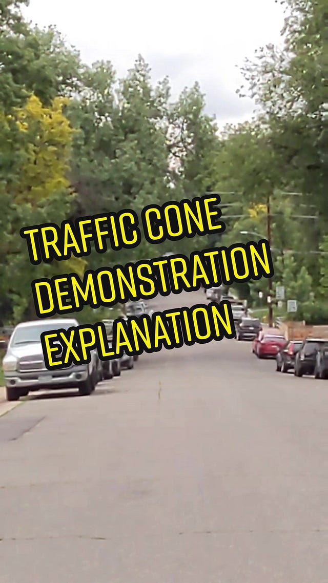
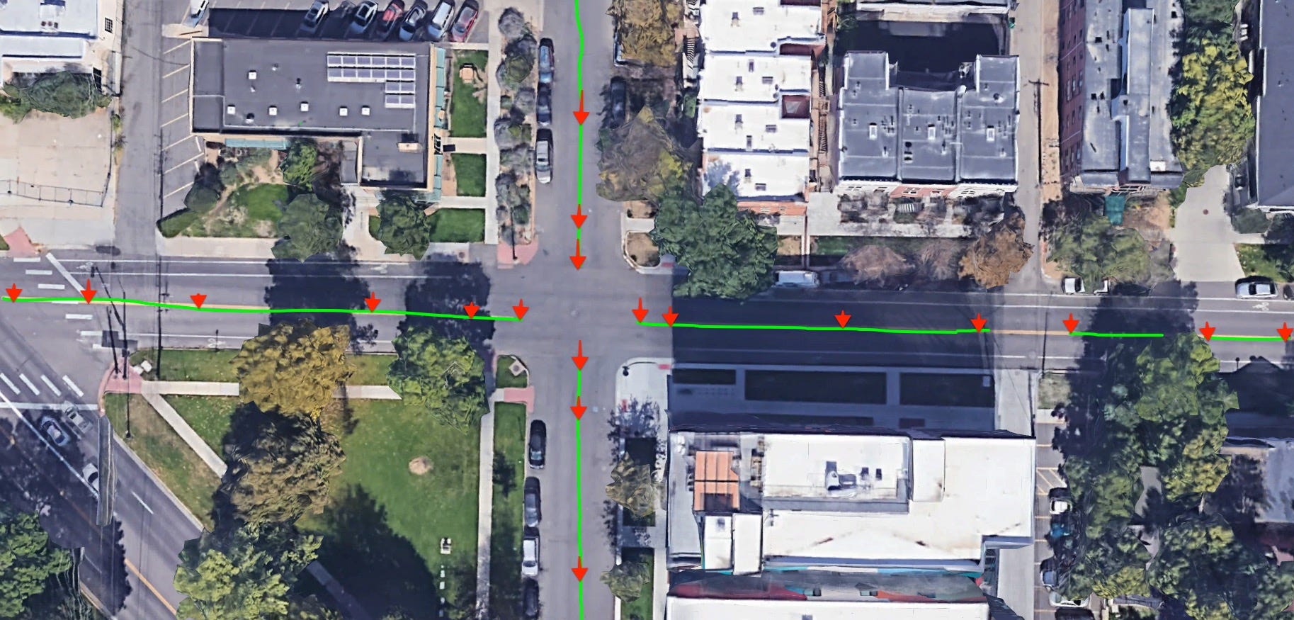
I ended part 3 a few days ago with this image, focusing on an intersection next to where I live, that I can see out my window and can hear when I am home.

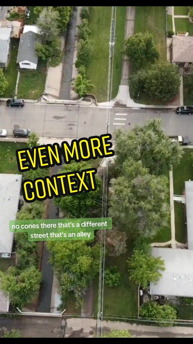
The annotations list but a fraction of the potential points of conflict, going through but a fraction of the intersections visible in this screenshot.
I could list 40 more, easily, just in this satellite image, and standing anywhere in the area for ten minutes, we could point out another few dozen points of potential conflict.
I’m going to give a detailed explanation of how we could make the intersection safer, and a by-product is the intersection is that it also will be more efficient across any dimension that can be discussed1.
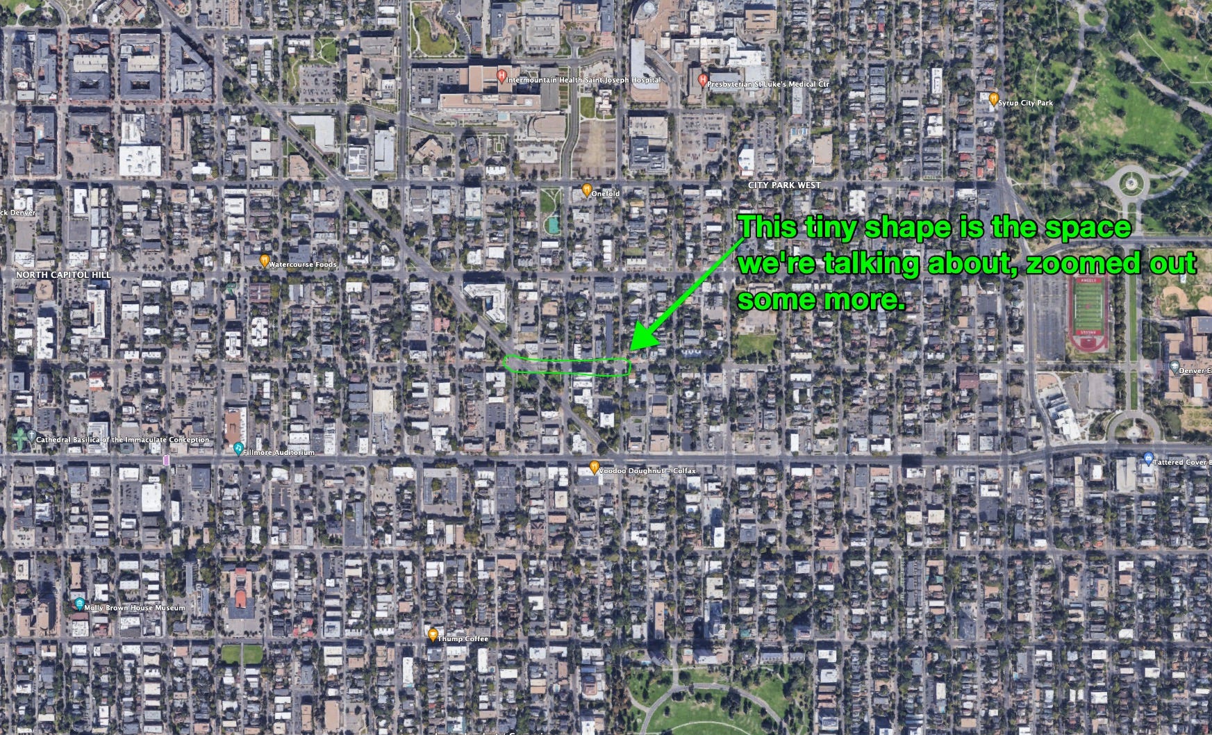
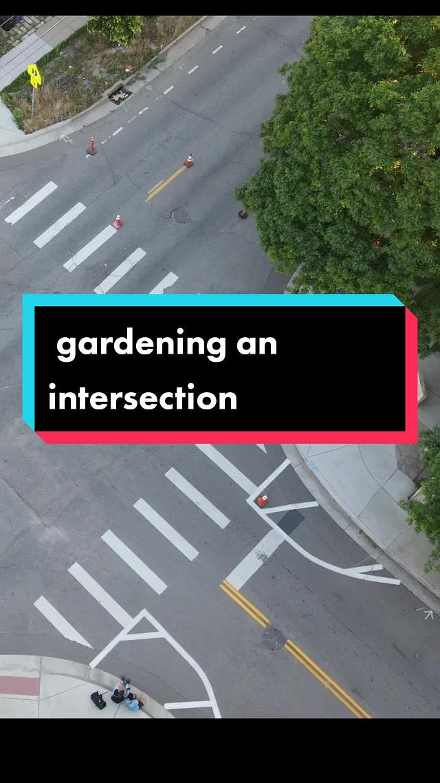
Lets imagine we were doing an experimental re-work of this exact/approximate area. Basically, ‘draw a shape, within the shape, apply a reasonable treatment’. For the purposes of this example, here’s a tiny enough shape:

It’s large enough that the effect could be felt/perceived, by anyone deigning to show up and observe in person.
It’s tiny, overall, thus it or something like it could be treated as an experiment, pure data-gathering:
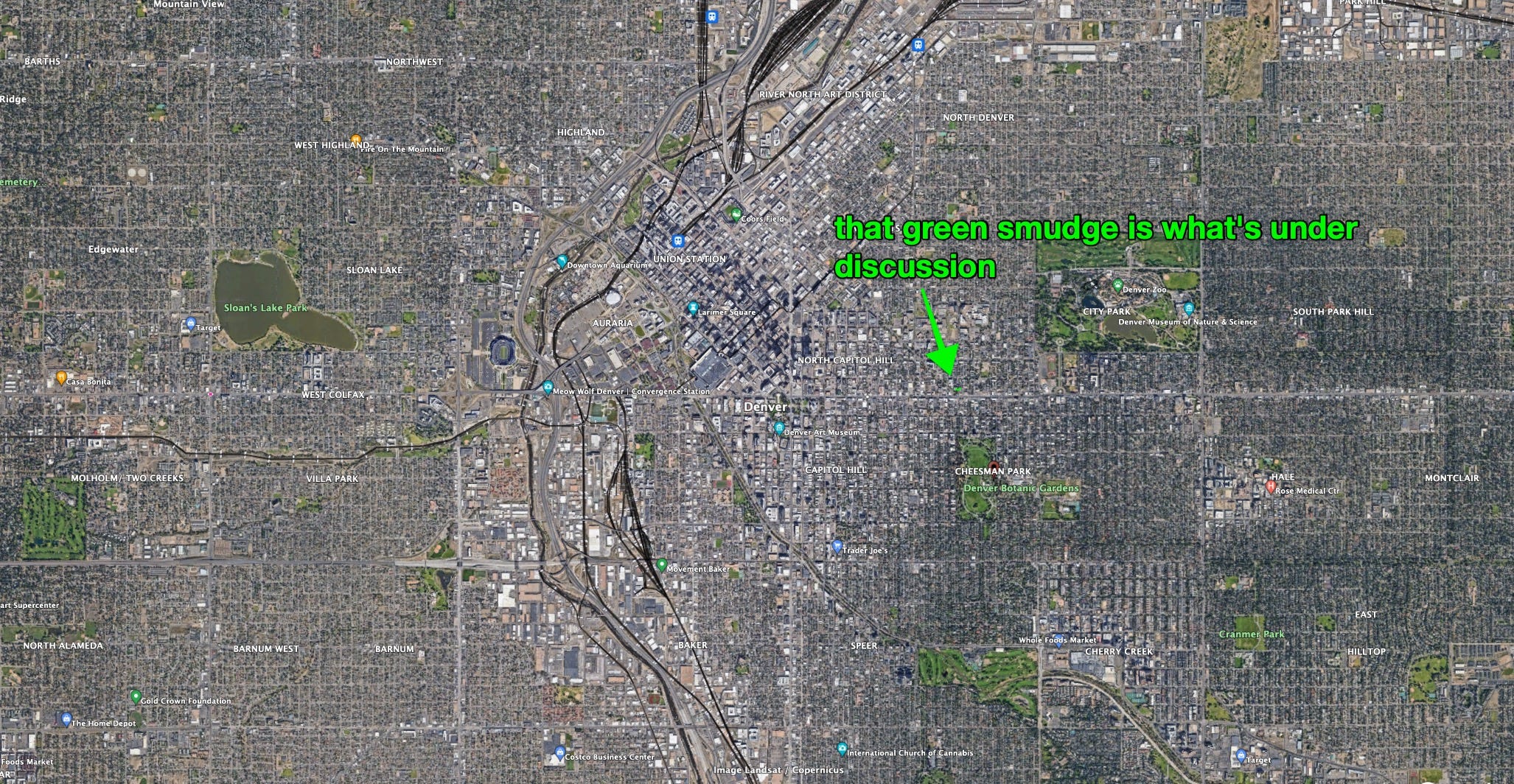
another view:
I’ll stop burying the lede and say I’d hope to see 17th (and thus Park), and roads near it end up better.
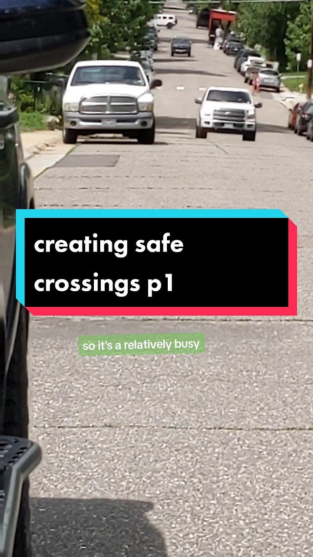
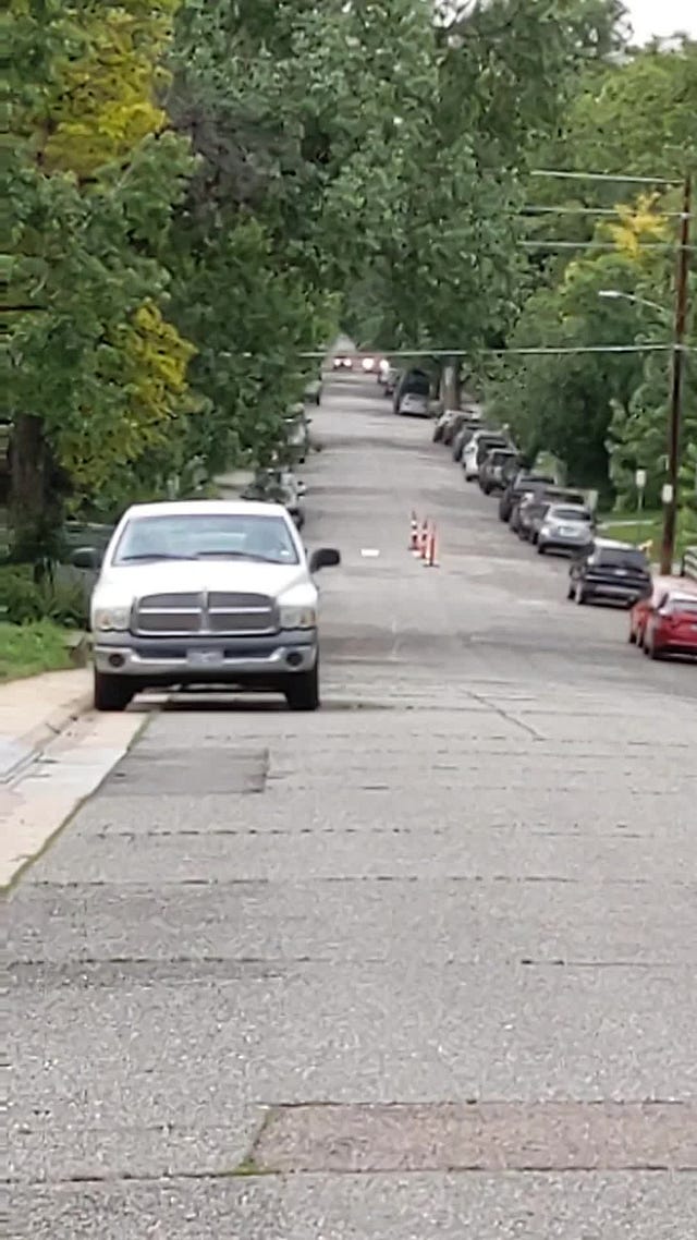
Here’s an example of how various people use a road like Park, elsewhere in the metro region:

 Tiktok failed to load.
Enable 3rd party cookies or use another browser
Here’s a larger ‘shape’, showing how if a satisfactory treatment is found for the two or three main junction types on 17th, it could be easily/reasonably extended:

The above shape would make better my access to the nearest playground, a boon to my daughter and I, and would make safer the many people per day who use 16th.
Even today, in it’s very dangerous state, 16th is vastly more pleasant to walk along than either 15th/Colefax and 17th, and 18th. It also has an order of magnitude more e-scooter, bike, e-bike, and running traffic than colefax or 17th.
It ‘collects’ quite a lot of east/west traffic, because despite how inadequate it is, it’s less inadequate than those other roads, thus people are drawn to it. This principal is useful to keep in mind for later.
I use Cheesman Park and the Botanic Gardens quite often, probably at least every other day
I use Cheesman Park and for $8.33/mo, access the attached Botanic Gardens, through the cool Key Fob Door Access ‘locals beta’.
Every time I pass between my house and Cheesman, I think about making a route to Cheesman park, via Franklin, that feels like an extension of the park2, so I’m mentally/emotionally holding a route like this in mind, too.
To recap, here’s where I’ve ridden my scooter (teal) and walked (yellow) in this same area:

There’s other intersections, in and outside of this image, that affect the flow. There’s a whole thing I could write about alleys, and alley access. Lets simply establish some starting points.
I overheard one car accident on a snowy day, right outside my window, and I witness near misses, constantly, in all ways.
Primitives For Repair
We’re drafting heavily on Christopher Alexander’s work here, specifically his concept of ‘patterns’: find a problem/solution ‘pair’, apply to any instance of that problem. Here’s the best article I’ve yet found, as an introduction to his work. Read the section titled “Pattern Era (1970s-80s)”.
I also mentioned in a previous episode a video of an intersection in the UK that was ‘repaired’ in a way that surprises some, but might be obvious to someone who’s been exposed to different transportation norms. I suggest watching that video, at least the bits I highlight in the article, before continuing.
To repair a piece of a mobility network, there’s a few starting points. Since work would start being done on the intersection, the first step might be to make it safer for the people doing the work, in the same way you’d want it to be safe for you if you were doing the work.
Step 1: at each access to the treated area, reduce all car traffic to a single lane max each direction *if* there are any streets with more than a single lane either way.
This “make things safer for the people doing the work” is something we have all seen and experienced, first hand. For so many reasons, it’s dangerous to cross more than a single lane at a time, and two lanes in a single direction is a simple no.
In the above example, this would be Park Ave - it is an unbelievable five lanes wide, in an urban area. Two lanes each direction, and a ‘turning lane’/russian roulette 💀lane in between. 🙃 We’ll talk in detail about it later, but as a point of safety for the crews doing the work, operating in the space, all inbound lanes would be brought to no more than a single lane in a given direction.
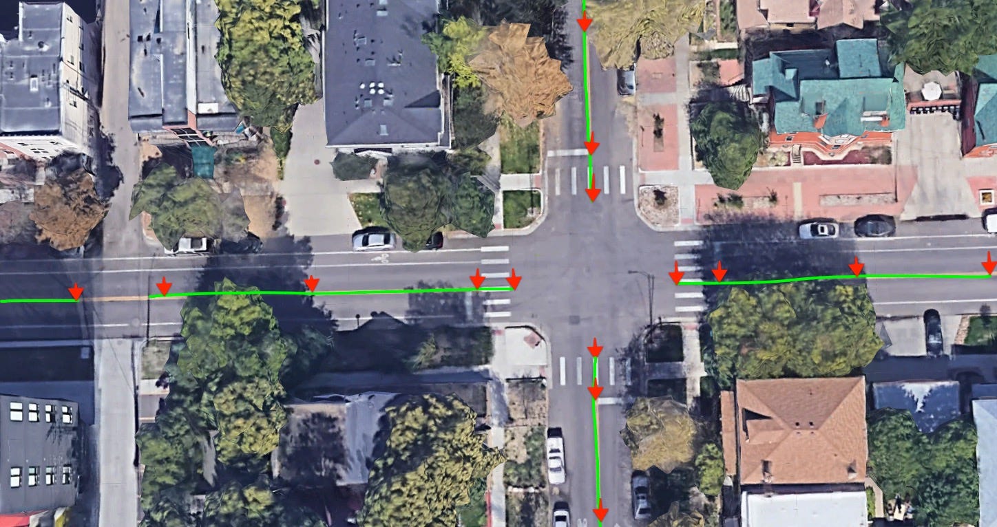
Step 2: visually separate the lanes, continuing from the access points
We would ‘dot’ cones between the lanes, as minimally as possible, to convey an expectation that the lanes are clearly separated, and it’s expected that one stay within the intended path of travel. (I.E. no drifting across the center line to pass around a car who is making a right turn).
Traffic cones, from the get go, makes sense, but there’s lots of nicer-looking, street-furniture-esque, slightly-more-fixed-but-still-movable options that’ll play a role later.
Below is an example of step 1 & 2, the green lines showing the ‘shape’ as it would appear/feel to drivers using it, and the red icons showing where the actual cones be placed.
Here’s why I’m focusing so much on “just” cones de-marking center lines. Part 1:
 Tiktok failed to load.
Enable 3rd party cookies or use another browser
Part 2:
 Tiktok failed to load.
Enable 3rd party cookies or use another browser
part 3:
 Tiktok failed to load.
Enable 3rd party cookies or use another browser
more footage of the cones. Note how unobtrusive the cones are from most points of view, like from the pedestrians crossing the road as they walk along a path, or from the dronet, compared to how visible they are when sighting “down” the road, from the POV of a driver:
 Tiktok failed to load.
Enable 3rd party cookies or use another browser
now, timelapse footage of people in cars and on foot, sharing the space:
 Tiktok failed to load.
Enable 3rd party cookies or use another browser
Later, a friend and I did another iteration, it should be obvious what we were going for:
 Tiktok failed to load.
Enable 3rd party cookies or use another browser
Note that I’m suggesting cones on both sides of all crosswalks, on the center-line of the road they cross, and at least a few markers along blocks.
Here’s more:
I promise, with my whole heart, my whole chest, that if you or someone else did nothing but put cones down, separating the lanes of traffic, in a close-to-the-above pattern, the rate of exessive speeding would go down, while the noise and rushing energy would also go down - when drivers drive around this kind of treatment, they just ‘coast’ a little more, instead of racing then breaking then darting through narrow gaps of crossing traffic.
The whole area would become safer and more enjoyable to use, including for the vehicle drivers themselves, (even the ones in a hurry once the red lights are replaced with flowy, first-in-first-out junctions. More on that below.)
Step 3: Bikes do/can/should move in the opposite direction as cars & should use the combined total street space.
Here’s the first change that would be made, besides just delineating existing lanes:
If there’s 3 feet bike lane in each direction, “combine” it into a six-foot-wide two-way bike lane on one side of the vehicle traffic.
There’s an odd pattern in Denver to put a small, inadequate bike lane on the outsides of the street, one ‘lane’ going each direction, in the same direction as traffic. There might also be a seam in the asphalt between the road and gutter area that you’re expected to navigate. It’s woefully inadequate and you can tell that many people riding on them are anxious and hyper-vigilent in their posture.
This distinctive allocation of street-space is obviously born out of a need to stay compliant with a written document.
Bikes (and the people riding them) can negotiate riding towards each other, and not hitting each other, as long as you give a smooth enough, wide-enough surface.
This “smooth enough surface” is not often-enough encountered in Denver/America but we’ll address that later. Here’s how to push bike lanes to one side, car lanes to the other. Demark with enough cones that everyone knows to disregard the paint.
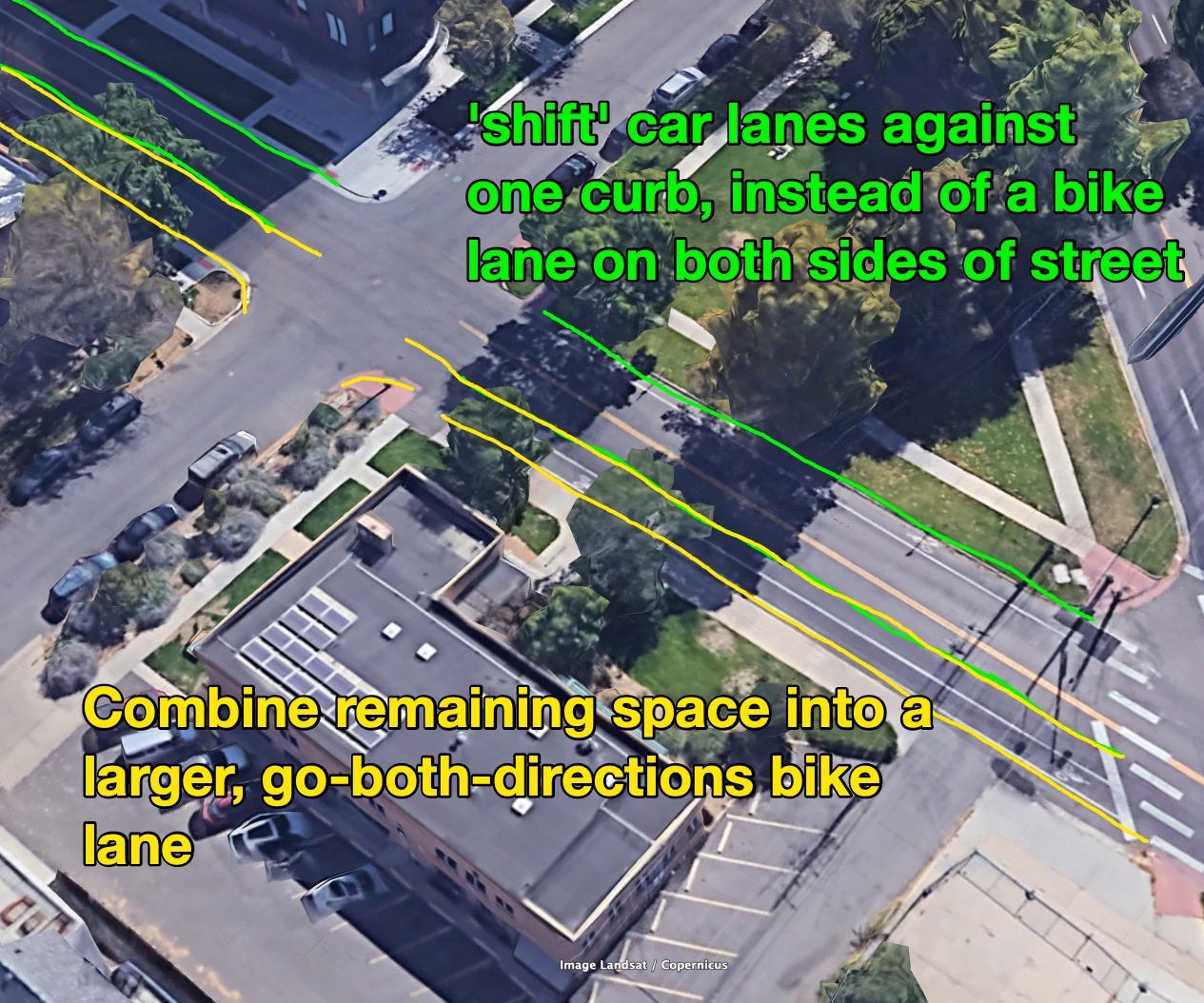
Again, this is an easy, incremental upgrade from the prior state.
There’s a lot that could be done by adding a little paint, like art and wayfinding, but that’ll be discussed in a future episode.
Real Life Examples Of Center Line Demarking
So sorry for what might feel like ‘getting pushed into tiktok’. I found it the easiest way to try to cobble together footage and get something edited and posted. I’ll prob pull the files from tiktok and re-host elsewhere for sharability/permanence, “someday”.
A norm for me, using a computer, is to hold down the command or control key, click a link that I want to look at. (this ‘command+click thing’ opens the link in a new tab, but doesn’t change the ‘current tab focus’ to that tab. I’ll look at the tab later, or maybe go look at it and then close it, and return to what I was reading. Feel free to try it on the below links, if you’re on a device with such a physical keyboard while reading this, as I am when writing it)
Here’s an example of cones I put down on 11th, west of Speer, in Denver. I could tell stories about it. Tejen and I observed so much, before, during, and after.
Here’s some cones at a pedestrian crossing, they seem so stinking visible in this video, yet nearly invisible in this one.
Benefits observed, after placing these cones and others
I’ve got many more videos of ‘cone stuff’ floating around, and I’ve certainly placed cones and not been able to record it. I dislike a stated (over)reliance on data, though. Sometimes gives ‘low imaginative/memory recall capacity’.
The benefits i list below are hard to perceive in the videos, because any time there’s a video time lapse, which is most of the time I post video, a sense of speed is totally lost, thus any ability to appreciate the effect the cones had on speed and sound is lost, and that’s obviously one of the main wins.
nearly always drivers would do something like coasting through the intersection/area, rather than accelerating
the whole area was quieter, an “always-on” benefit to everyone within a few hundred feet of the area, 24 hours a day
safer and more emotionally peaceful for people who are biking/scooting/walking, especially if they do not have a desire or ability to ‘rush’. Children. People using the road in the snow. People who don’t want to look 100 meters in both direction for cars.
more peaceful for the drivers. I vastly prefer to drive in areas treated in the above way. I really don’t like the potential violence that could be unleashed by the vehicle I drive, even when I drive in an as-carefully-and-attentively-as-possible manner. Other people racing to ‘beat a light’ late at night and the roads are empty? ick.3
Junctions: Dealing With Park Ave
I did not talk at all about junctions in the above treatment. This part of denver has lots of junctions, some parts of town have less junctions. This pattern is applicable for all junctions, when paired with the above treatment. (i.e. single lane traffic is approaching the intersection.
Did you watch the video about Poynton? At the 11:30 mark, talking about ‘single lane of approach traffic’ thing. Note, the local streets authority has to hang probably many “shared space” notification signs (one of those signs is visible at 12:44) so drivers know things are different, and then everything goes.
The “Park Ave” end of this little bubble of space is a “very complicated” “signalized intersection” containing at least one quite wide road. I sometimes like the really wide roads, imagine how much space can be pleasently restored!
The only question is where on park one would start reducing the two-lanes-each-way to a single lane. Consider referring to the 11:30 mark of the Poynton video, you can see it doesn’t really matter where it gets reduced.
Also, to get drivers down to the right speed, you wouldn’t expect them to shed speed too fast - really, park should be a single lane, dramatically reduced, all along it, so it’s a little jarring to suggest an instant transformation from “five-lane Robert Moses Urban Highway” to single-lane-each-way traffic circle vibes in just a block or 100 feet.
I’d say at least from Colefax, and at least a block towards the north, Park Ave could/should get this treatment, but now we’re changing the blobby bit. Alas. This is all just different slight modifications of the basic, small shape.
It has taken me far longer to write this blog post than it would to drop cones throughout the area and start seeing improvements, both at “my” intersection, and this whole area. Alas.
Note how long it took me to place cones here.
I filmed the whole thing. It takes no time at all.
Hours later, passing through the intersection on my scooter again, liking the initial results, I picked up some more cones from a spot where maybe 50 were stacked around a sidewalk redoing project.
As I loaded a few on my scooter, I noticed a white late-model pickup truck at a distance, with people inside, parked on one of the many city lots.
It was late at night, perhaps on a Sunday, it was a bit unusual, but I wasn’t concerned/cared, I didn’t even notice at first, the distance was so great.
I loaded up the cones, then rode the short distance to the intersection in treatment.
I dropped the cones, very soon after that pickup truck rolled up, and to my surprise it was department of public works employees. I started with the obvious sentiment “I am so sorry for whatever happened that you’re out here working on a sunday night.” They were nonplussed, a bit authoritarian, uncurious in certain familiar ways. They expressed obvious “dismay and concern” over what I was doing. We talked about it, they seemed to not feel comfortable demanding that I undo it, I was sort of resisting the energy, too. Partially curiosity, partially just exploring how they were processing the experience. (“Are you required to report this cone here as an incident in your CMS, once you see it, or did you drive past it the first time and not think a lot about it?” “Oh you’ll maybe have to get the police? Is it a ‘you’ll get in trouble if you do not call them’ thing or a ‘you are threating me with the police if I don’t comply?’ thing?”4
Let’s talk about Park. In the below photo, I’ve changed the perspective, so now Park is going left to right. I’ve circled in green the part of this ‘blob’ shape we’re discussing that extends into Park.
It might difficult to appreciate in satellite view how wide that road is. It’s utterly inhospitable and unenjoyable, and very amenable to being treated like a highway, as drivers time the lights, or achieve a few seconds of fast movement in an otherwise dying-in-traffic commute.
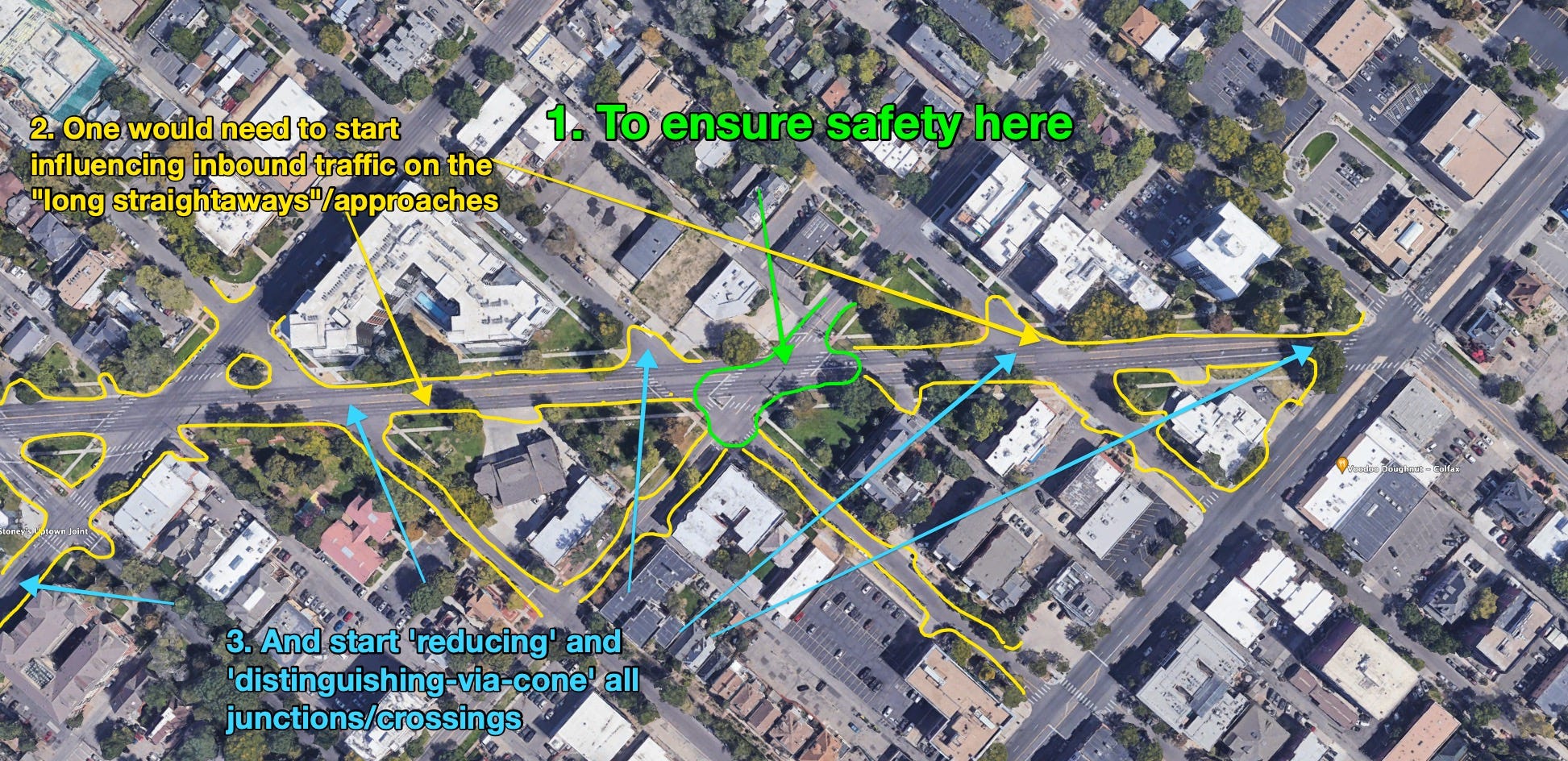
So, the yellow shows the areas that would need treatment in order to ensure that people are not approaching the intersection ever at 50 mph, or almost never, and that it’s much safer and more bounded if they do.
Look at the video linked in Interlude: A Pattern Of Repair again. Then jump to the 11 minute mark. See how different the vibe of the intersection is?
This is the shape and concept I’d start pursuing (and could be achieved) with cones or cone-passing structures:
Here’s how we’d replace the current lights with Poynton-like ‘traffic circles’. I admit that three seems rediculous, and there’s ways around it that will be discussed in future episodes. For now, this would count as “good-enough intermediate spot repair”.

Easy.
In a future post, we could talk about patterns for crossings of different modes (people/car, car/bike, bike/people) but this would be a very, very good starting point that would, oh by the way, dramatically reduce the time vehicles spend getting from one side of this area to the other.
Here’s yet another axis on which I can say “I have legible data collected”:
https://joshs-mobility-data-54dab943ebba.herokuapp.com/?zoom=19&latlng=39.741566,%20-104.969673
If you click that link, it’ll take you to something like the below screenshot5:

More on that next time, this post is long enough.
🛵, Josh
PS In the next edition is a brief interlude about tinted windows, and some unique, distinctively local phenomena about those windows, and the effect it has on other users of the same space. update: here it is.
Alternatively, and more enjoyably, I’m also working on a piece about “Linear Parks”. I sort of needed this piece out of the way, to explain why I think it’s reasonable to expect to easily ‘reclaim’ some long and thin shapes on the ground that could be given ‘linear park’ treatment. Here’s the draft, for now.
That would make it possible to enjoy some of the beauty of a place like Cheesman not only as a destination, but also as a path, ferrying you from one place to another via wide, smooth, quiet, paths, trees, mulch, wildflowers, benches, and more, obviously.
I resent making space for ‘efficiency’, though, because it implies that safety needs to ‘make a case’ to be prioritized over efficiency. This has often-enough been the rhetoric of racial supremacists, and I’m reticent to dignify it by taking it seriously.
And Voodoo Donuts, which I visit on my way to the park regularly. It’s a 10 step detour.
the other day, I almost hit someone with the car I was driving!!!!
I was stopped at a large signalized intersection, somewhere on Wadsworth, near Colefax, at the front of a stopped line of traffic in the right-most lane. sunny, clear summer weekday morning, I was driving a small sedan, with my toddler in the back seat. We were chatting with each other. I am appropriately disappointed that this stage of my life has me driving her to a camp in a car.
Anyway, while at the red light, two people walked across the crosswalk, in front of my vehicle. We are near many grocery stores and houses and other types of places. Walking around is very reasonable. I didn’t think anything of it. I always stop far-enough back from the intersection that I can see the ground of the entire crosswalk in front of my vehicle. If there were a 2 year old standing on the near-end of the cross walk, I would see it. I could see their whole bodies while they walked across the intersection, as usual. Again, didn’t think anything of it. I knew they were coming, because I could see them, chest-up, in front of the vehicle to my left.
It was a boxy SUV next to me on the left, pulled closer to the crosswalk than I was.
The light changed to green, i took my foot off the brake and was about to put pressure on the accelerator. I always ease into motion, in a car, especially those streets/my child in the car. I don’t race or rush, even when at the front, so I wasn’t rushing. I noticed that the vehicle to my left that, though ahead of me, was not racing off, not that this meant anything.
Right as the car was starting to move forward, from the left,completely obscured by tall hood of the SUV to my left, next to the vehicles front headlight, popped into visibility a man in a wheelchair, obviously rushing to cross the street!
I instantly was on the brakes and stopped, but if I had hurried at all when the light changed, AND/OR was driving a large vehicle with poor sightlines, maybe had loud music or was in a rush or was trying I don’t see how a slightly different ‘play’ of that situation has him very, very dead.
It angers me that I would not have been considered to be ‘at fault’ in that situation, nor would the city engineer who oversees the safe operation of that intersection. The police officer would say/report:
oh, the pedestrian was in the road but the light had changed, it was no longer appropriate to be in the road, see, they started crossing late, they should have waited for the next light cycle if not able to cross it in the appropriate time. Oh well. They got crushed by a vehicle? Well, drivers should try to leave adequate sight-lines, but really the victim/pedestrian shouldn’t have been there. The intersection was designed in accordance to ASHTO 145.434.221, and the cars are all in spec. The driver stayed on the scene, the Civilian Crash Investigation Unit reported it. So sad.
I don’t begrudge an individual police officer. I deployed my standard “lets talk about road networks” strategy. Police deal with car accidents all the time, so I always start there. “Did you notice that *points over at the road* when it snows, the visibility coming around that corner is such that…” but no dice this time. The officer was also unimpressed that a city engineer of a different municipality in Colorado gave me permission to use traffic cones to improve safety outcomes at high-conflict intersections. I communicated my earnest intent to not so misbehave again:
me: “if I had a letter from the city engineer saying this was cool, would I be allowed to proceed?”
officer: “well obviously but you don’t, do you?”
me: “no, but will you believe the things entities will put in email? I’ll talk to him tomorrow, officer. Won’t do anything untoward and unapproved in Loveland again. ✌️”
I did nudge things with the local city engineer, got email approval to run traffic cone experiments on a connecting intersection to the above, but alas I obtained that permission while out of country, and when I returned to town I moved back to Denver, and it was the winter, so the momentum petered out. It was more proof-of-concept, which I feel pretty good about having obtained.
I’m always noodling on this little data visualization project, and things change often enough, so it might be different by the time you click the link. Here’s a backup link